David's Google Earth files
|
Google Earth is a fantastic tool; it can make the Earth so small it could fit in the palm of your hand, or it can allow you to see that changes we are causing on the planet are so big they can be clearly seen from space.
This page is a collection of my experiments with Google Earth as a tool for highlighting and visualizing environmental issues.
|
KML files (RSS
 )
Programs
Personal
)
Programs
Personal
|
(2009-01)
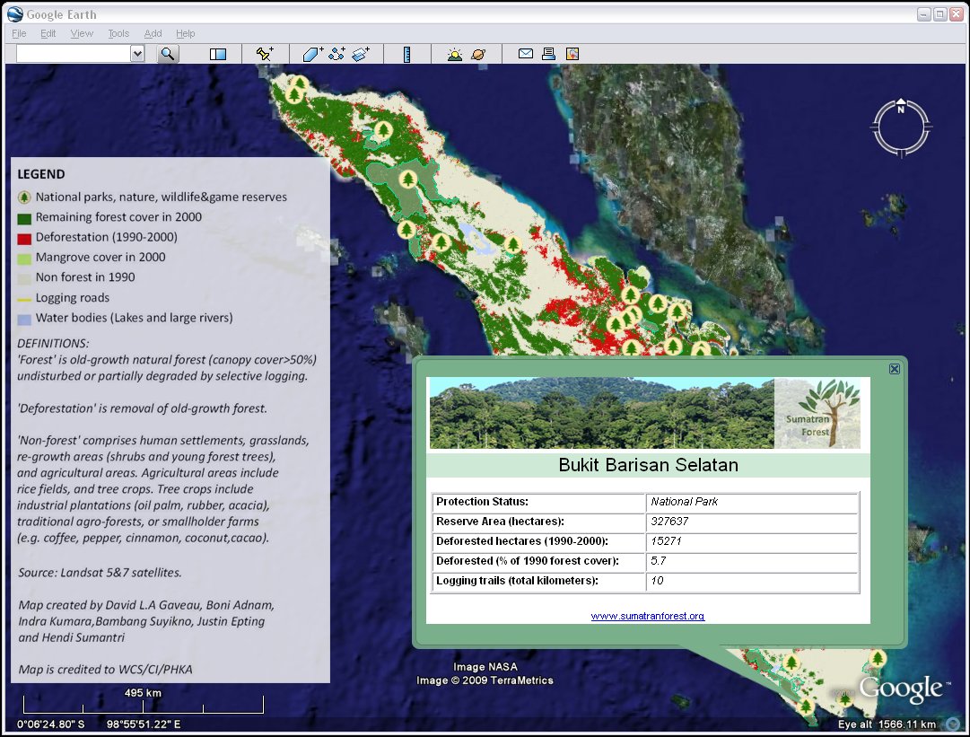
Sumatran Forest: Mapping DeforestationThis KML is a project by my friend David Gaveau to present deforestation data for the island of Sumatra in Google Earth. The data is the outcome of 6 years of research in Indonesia for the Wildlife Conservation Society and the kml shows deforestation data from 1990 until 2000 as well as protected area information and illegal road networks. The island is still home to small populations of tiger, orangutan, rhinos and elephants, but lost some 5,000 square kilometers of rainforest per year during the 1990s - part of the reason Indonesia has become the world's 3rd biggest carbon dioxide emitter.(I've provided some technical help for realizing this project in KML) Visit sumatranforest.org to learn more: Sumatran Forest  Download Google Earth files
|
|
||||
|
(2008-07)
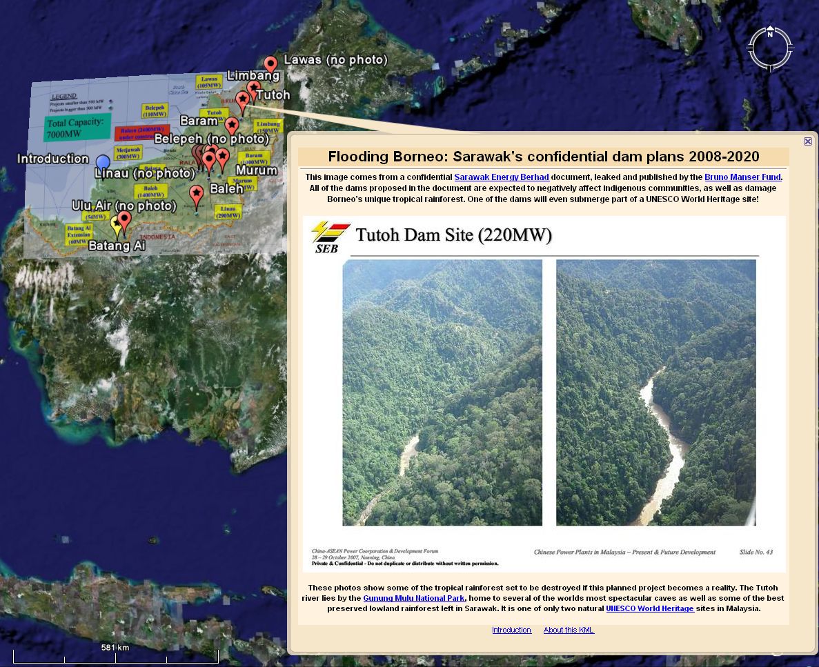
Flooding Borneo's rainforest: Sarawak's confidential dam plans 2008-2020This KML file shows information from a confidential Sarawak Energy Berhad (SEB) document leaked and published by the Bruno Manser Fund. It highlights the plans for a number of very large hydroelectric projects set to flood vast areas of rainforest and displace thousands of indigenous people, including Penan, Kelabit and Kenyah. One of the projects will even submerge part of a UNESCO World Heritage site!The leaked document can be downloaded from: Bruno Manser Fund Survival International
Open Google Earth file
|
|
||||
|
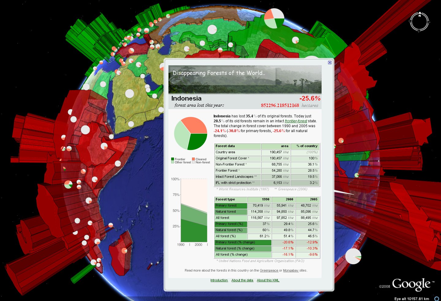
(2008-06)
Disappearing Forests of the World..This KML shows deforestation data from a number of sources for different countries, including a live ticker for each country.The world has lost close to half of its forests already today, and the continued high pace of deforestation contributes greatly to climate change and the loss of biodiversity.
Sources:
World Resources Institute (WRI): The Last Frontier Forests: Ecosystems and Economies on the Edge (1997) Greenpeace: The Worlds Last Intact Forest Landscapes (2006) United Nations Food and Agriculture Organization: Global Forest Resources Assessment 2005 Tools used: PHP(+Ming for flash counter) & MySQL: XAMPP, World Borders Dataset (+chartAPI-icon idea): thematicmapping.org Google Earth Outreach Showcase
Open Google Earth file
|
|
||||
|
(2008-04)
Black Tides: The Worst Oil Spills in HistoryThis KML shows information about the 50 worst oil spills, from tanker accidents and drilling operations, as well as a number of other notable spills. Did you know that some of the biggest oil spills in history were actually intentional?
Sources:
CTX: Center for Tankship Excellence (most complete tanker accident database on the internet) Cedre (very good database of oil spills) NOAA Incident News (oil spill case studies) Amazon Watch (information about Ecuador and Peru oil contamination) ITOPF: International Tanker Owners Pollution Federation (oil spill statistics) as well as Environment Canada Tanker Spills DB, Oil Rig incidents, InterTanko Tools used: EarthPlot, Google Spreadsheet Mapper Google Earth Outreach Showcase
Open Google Earth file
|
|
||||
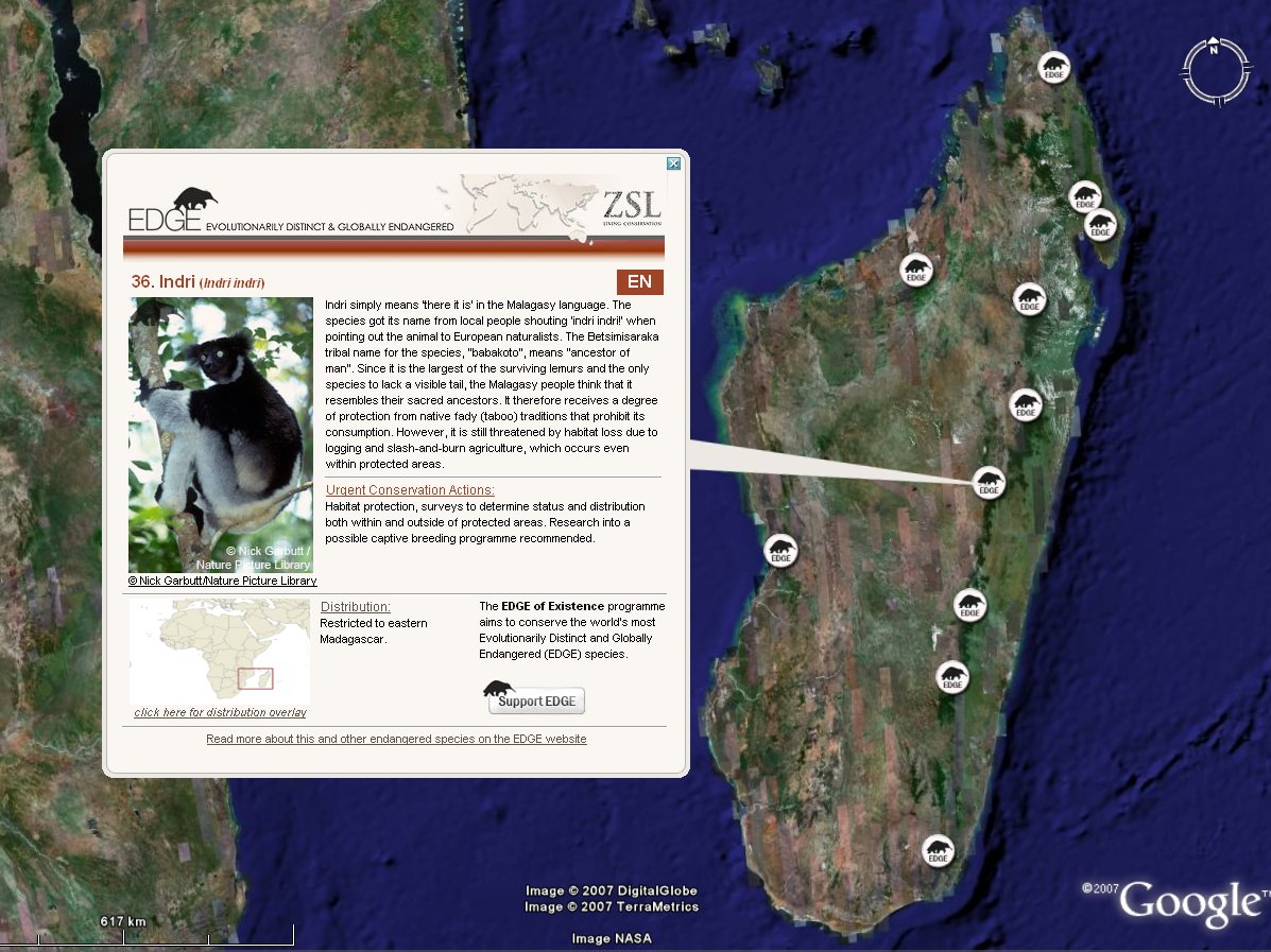
EDGE of Existance: MammalsThis KML shows 100 of the worlds most Evolutionarily Distinct and Globally Endangered (EDGE) mammal species. It was created for the Zoological Society of London's EDGE of Existence programme.Open the KML file to learn more about the Yangtze River dolphin, Cuban solenodon, Aye-aye and other unusual animals.
Tools used: Google Spreadsheet Mapper
ZSL: EDGE of Existence homepage Google Earth Outreach Showcase Google Earth Outreach Case Study Google Lat Long Blog entry
Open Google Earth file
|
|
||||
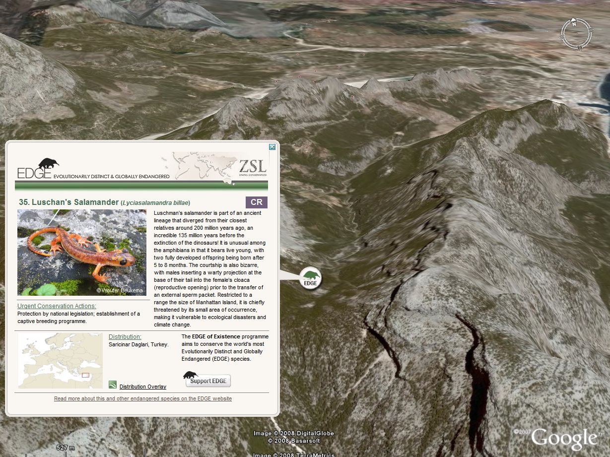
EDGE of Existance: AmphibiansThis KML shows 100 of the worlds most Evolutionarily Distinct and Globally Endangered (EDGE) amphibian species. It was created for the Zoological Society of London's EDGE of Existence programme.Open the KML file to learn more about the 1.8 meter Chinese Giant Salamander, the cave dwelling Olm and other unusual animals.
Tools used: Google Spreadsheet Mapper
ZSL: EDGE of Existence homepage Google Earth Outreach Showcase
Open Google Earth file
|
|
||||
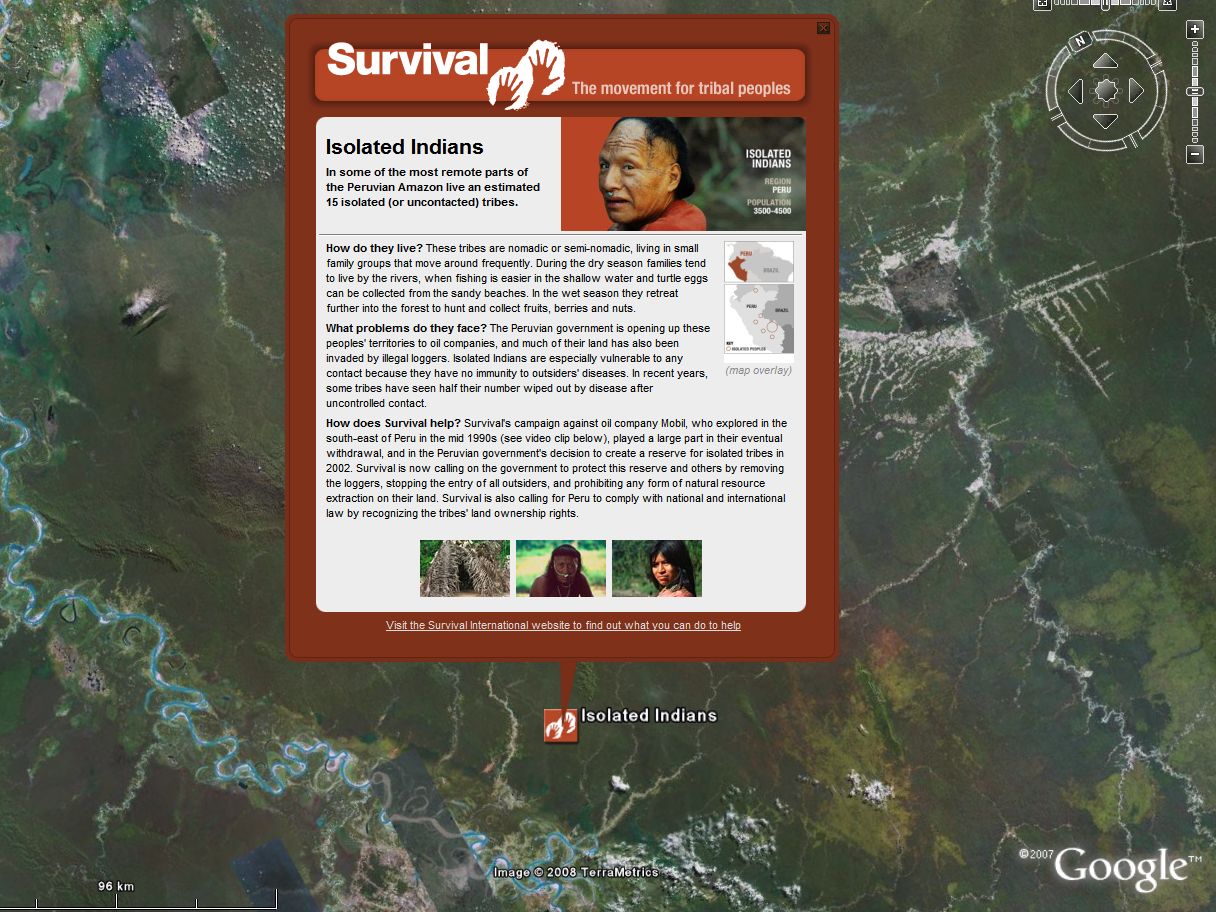
Survival International: TribesThis KML shows information from Survival International about 33 indigenous tribes from five continents.Survival is an organisation that works to support tribal peoples worldwide. The tribes in the KML are under threat from ranchers, loggers and miners invading and stealing their land. Many of the tribes have been decimated from previous massacres and forced relocations. Some of them still reject all contact with outsiders.
Tools used: Google Spreadsheet Mapper
Survival International homepage
Open Google Earth file
|
|
||||
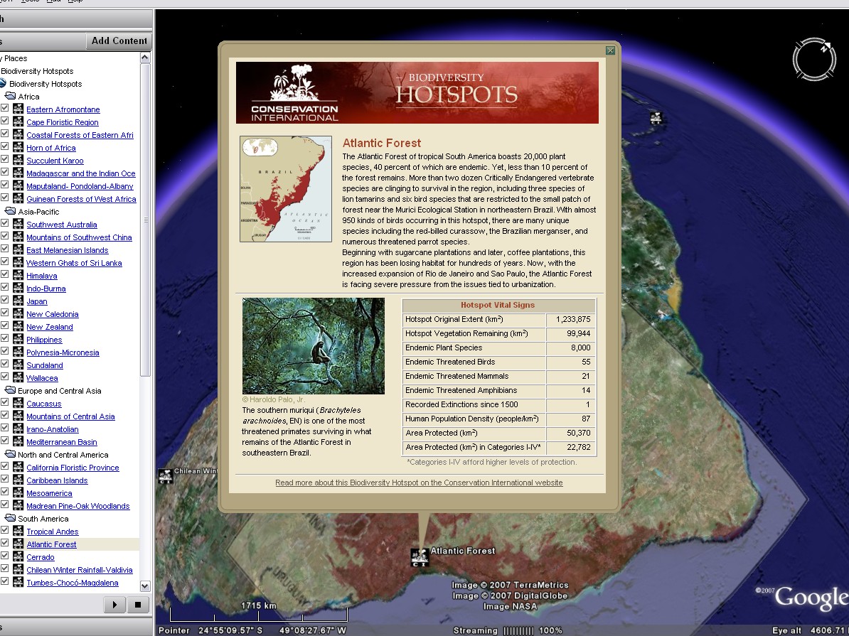
Biodiversity HotspotsThis KML shows information about the earths 34 Biodiversity Hotspots, as defined by Conservation International.These are the most important areas for conservation, with very large numbers of endemic species. Each of the hotspots has lost more than 70% of its original forest (some more than 95%) and the remaining habitat for all of the hotspots combined covers only 2% of the planet's surface. Yet over 50% of the worlds's plant species and 42% of the land animals exist nowhere else.
Tools used: Google Spreadsheet Mapper
Biodiversity Hotspots homepage Conservation International homepage
Open Google Earth file
|
|
||||
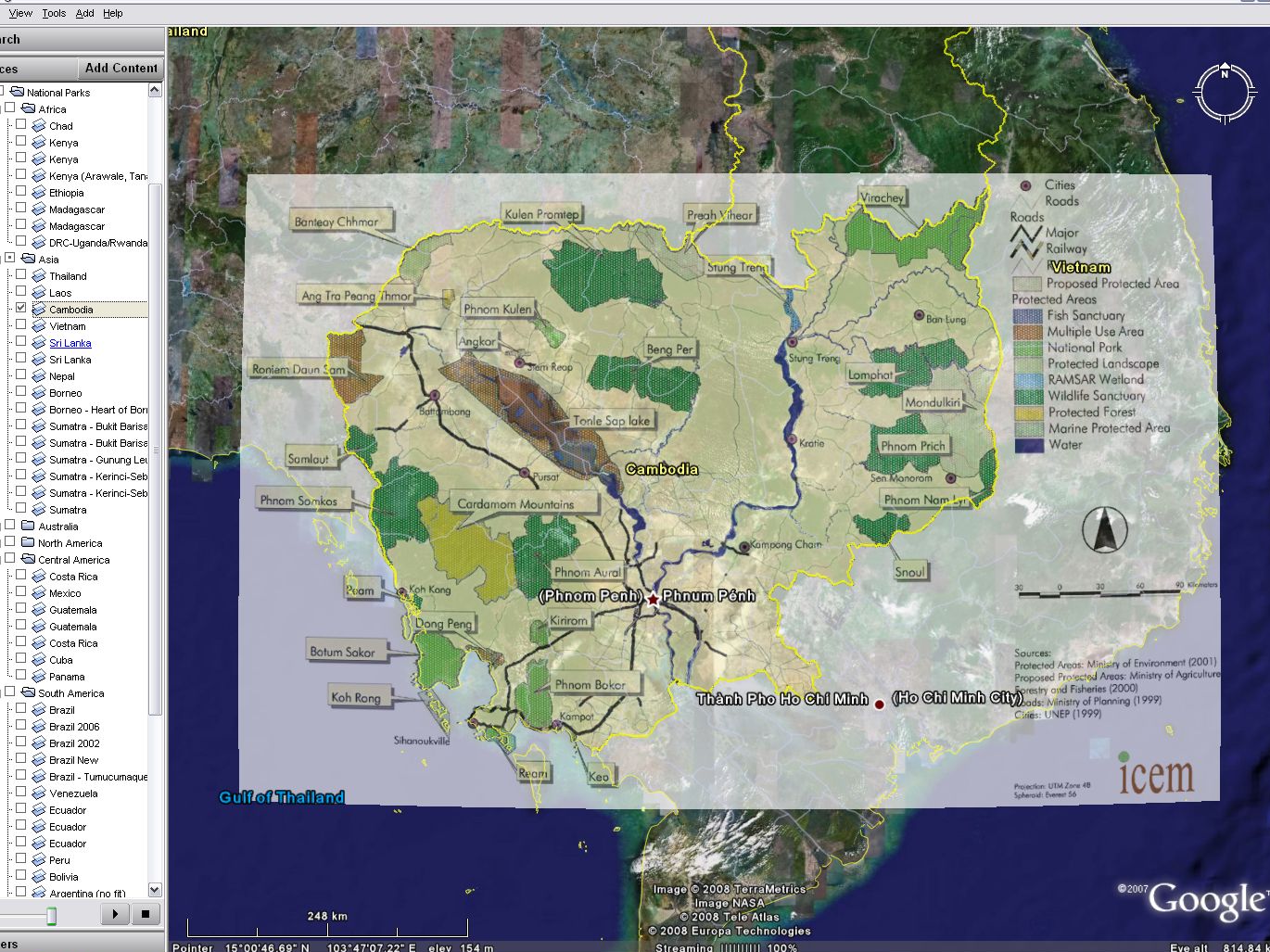
National Park overlaysThis KML has image overlays showing the protected area network for a number of countries. The overlay images are loaded from various sources on the internet. The list of countries is far from complete.Do not enable all the overlays at the same time (might freeze Google Earth).
Open Google Earth file
This KML isn't release quality, but might be of some use to someone... |
|
||||
All the above filesDownload this network link KML to load all the above files in Google Earth.(Drag the link into My Places in Google Earth to automatically receive any new files and updates from this page in the future.)
Open Google Earth file
|
|||||


ProgramsGoogle Code Open Source Project:http://code.google.com/p/googleearth-autohotkey/ |
|
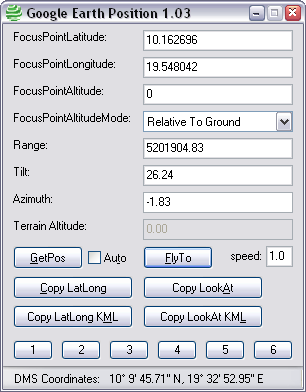
Google Earth PositionA small tool for reading/modifying the current position in Google Earth and copy to the clipboard. Useful for editing KML files, and for pasting coordinates into spreadsheets like the Google Spreadsheet Mapper.(source code: Google Code project) Download: GoogleEarthPosition.exe (version 1.08) |
|
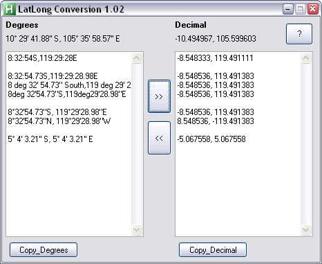
LatLong ConversionA small tool for converting between different format coordinates. Might be useful for editing KML files.(source code: Google Code project) Download: LatLongConversion.exe (version 1.06) |
|
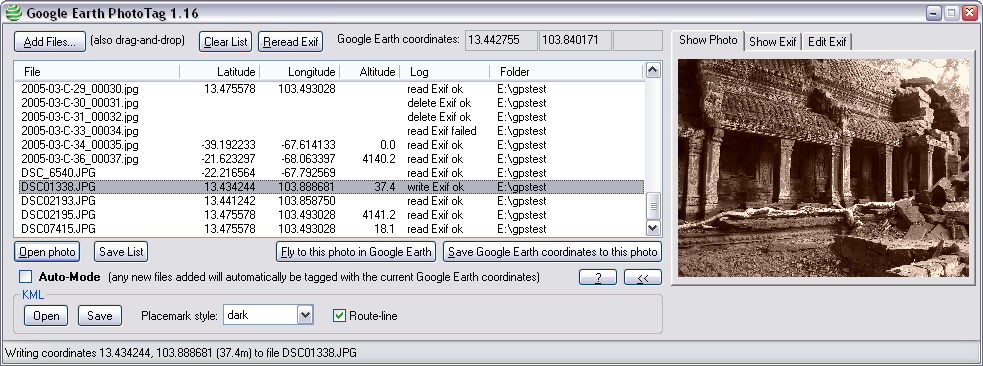
Google Earth PhotoTagA small program for adding Exif GPS data to JPEG files and reading coordinates from the Google Earth client.With the Auto-Mode enabled any new file drag-and-dropped onto the PhotoTag window will automatically be tagged with the current coordinates from the Google Earth client. Options to read/write Exif GPS data can be added to the windows right-click menu for JPEG files from the PhotoTag About: dialog. (source code: Google Code project) Download: GoogleEarthPhotoTag.exe (version 1.16) |
|
|
|
Extract coordinates from KML filesTwo small XSL files for extracting Lat, Long, and LookAt parameters from placemarks in a KML file. Handy for re-importing values into a spreadsheet after editing in Google Earth.To use edit the <kml> tag and add a <?xml-stylesheet> tag to your KML file, then view it in a browser (see instructions inside the XSL file). Download: getpos.xsl (extract coordinates as a HTML table) Download: getpos_csv.xsl (extract coordinates in CSV format) |
|
Personal |
|||||||||||||||||||||
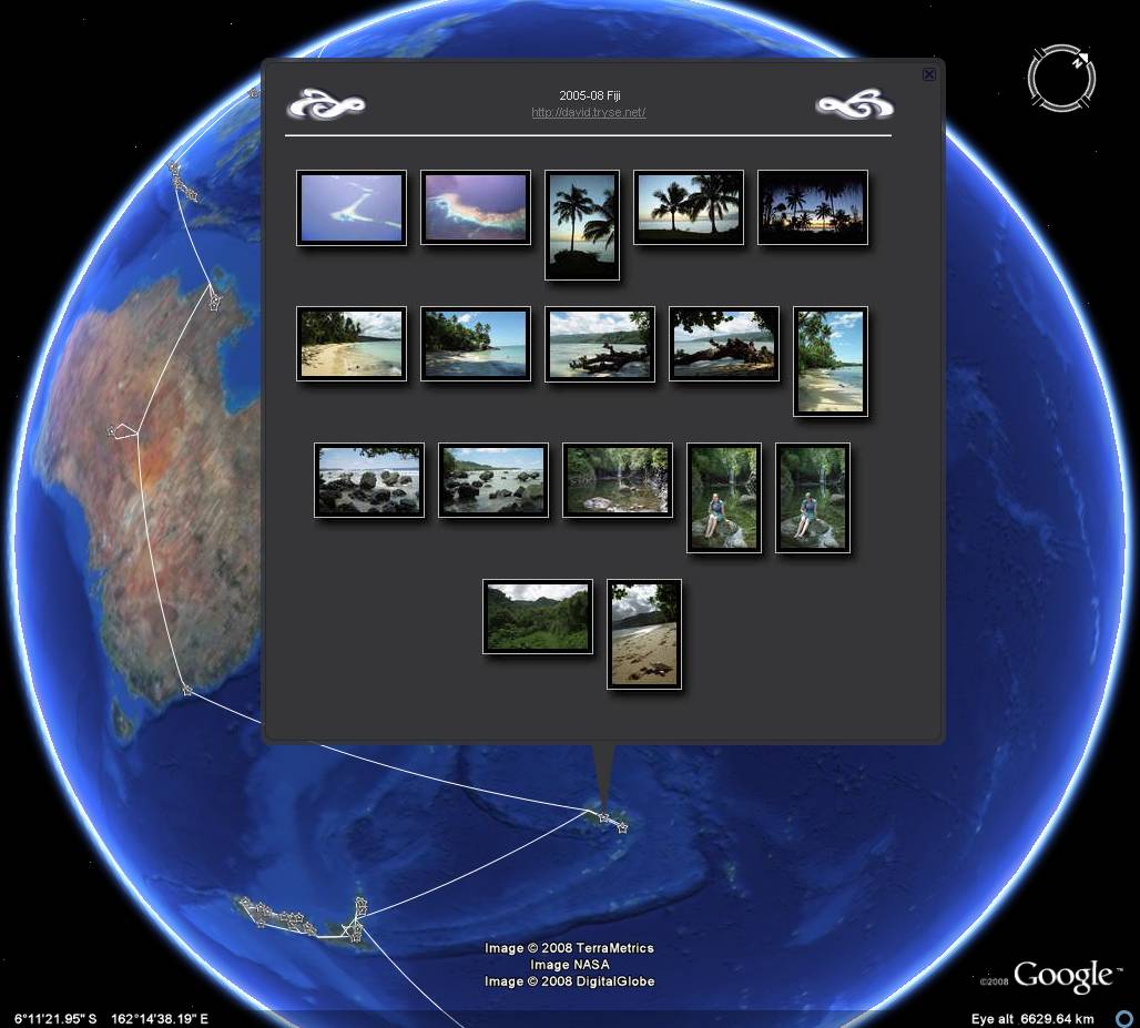
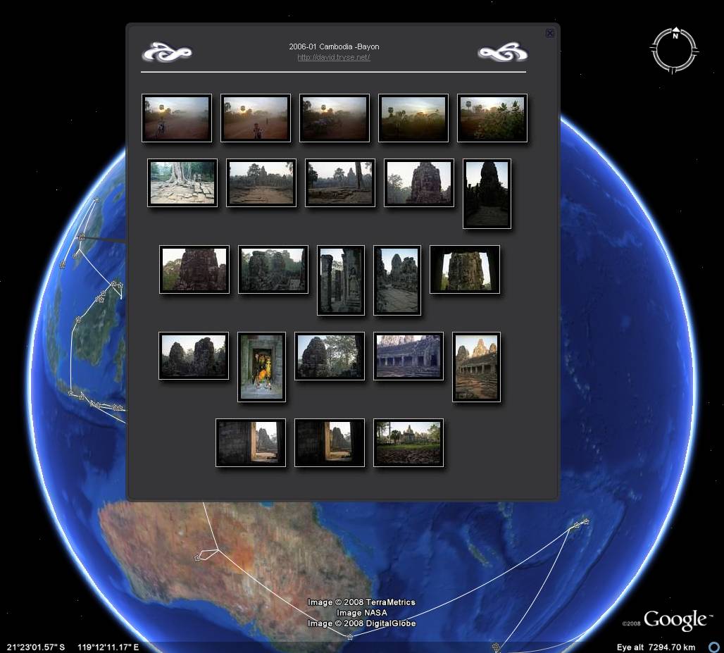
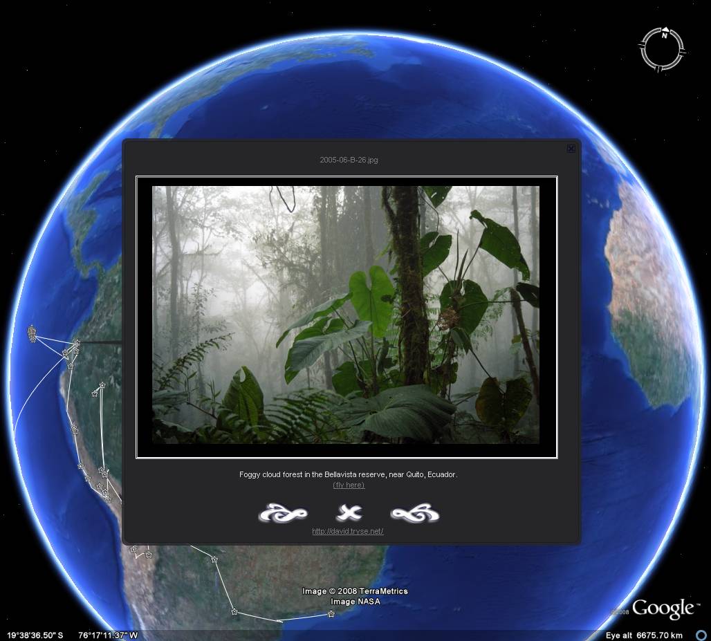
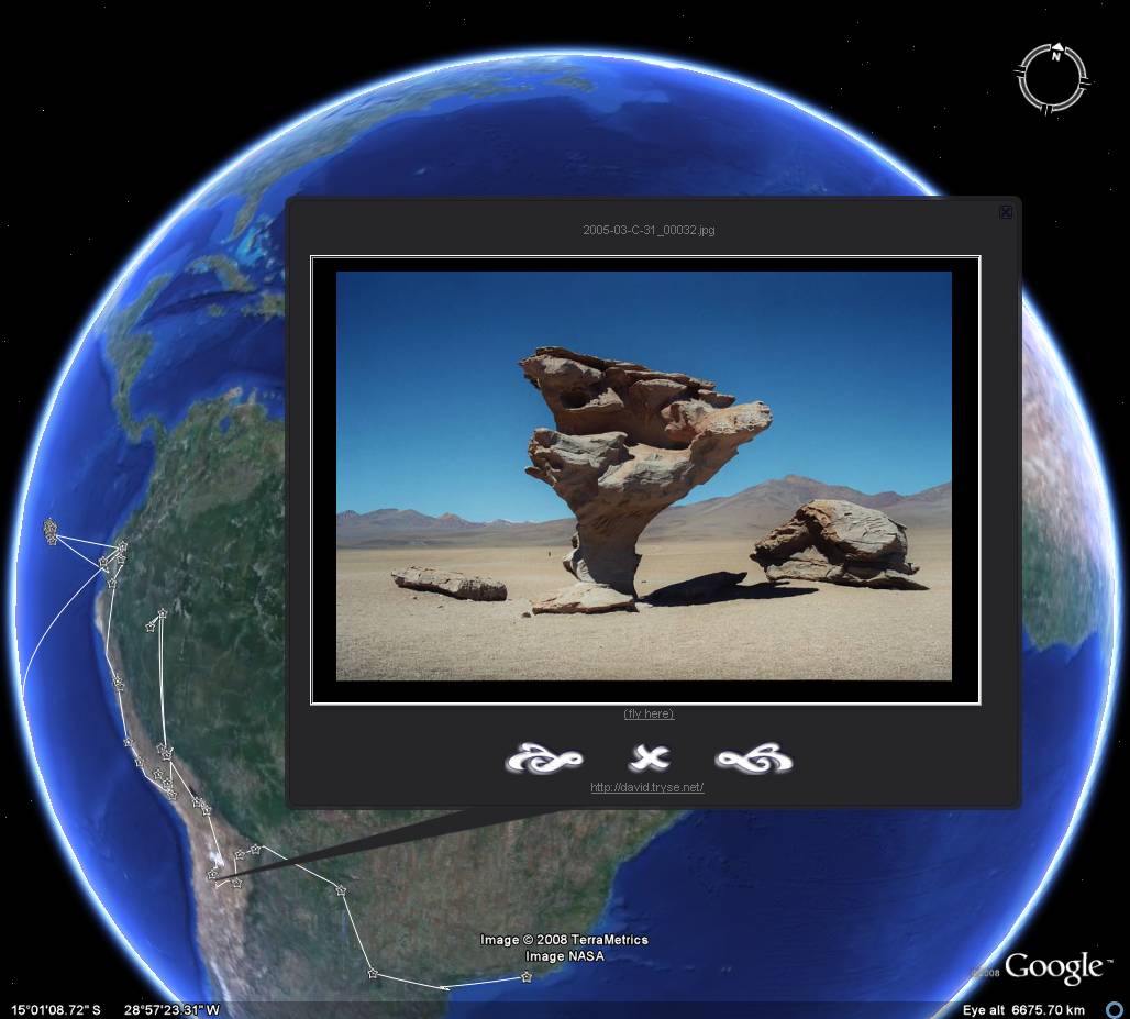
Round The World Trip 2005 PhotosTravel photos from 12 months spent on the road; Brazil, Argentina, Bolivia, Peru, Ecuador, New Zealand, Fiji, Australia, Indonesia, Malaysian Borneo, Brunei, Cambodia, Laos, Thailand.Warning: Thumbnail photo-index pages may be quite slow to load in Google Earth 4.3
Open Google Earth file
|
|
||||||||||||||||||||
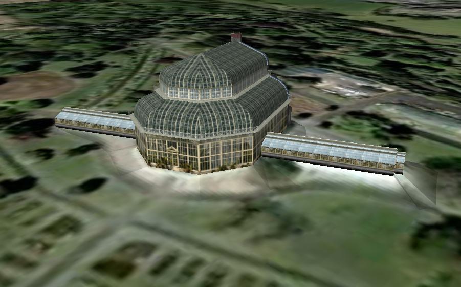
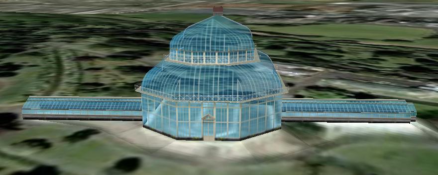
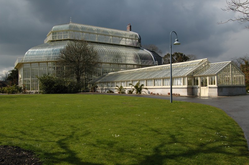
Sketchup 3D modelsMy experiments with Google's SketchUp 3D modeling program. The first model is the Irish National Botanic Gardens Palm House.Google 3D Warehouse link
Open Google Earth file
|
|
||||||||||||||||||||